Frankie Jenkins · 1 October 2026
Satellite Imagery Reveals Shifting Patterns in Baltic Seashore Corridor Usage by Local Wildlife and Hikers
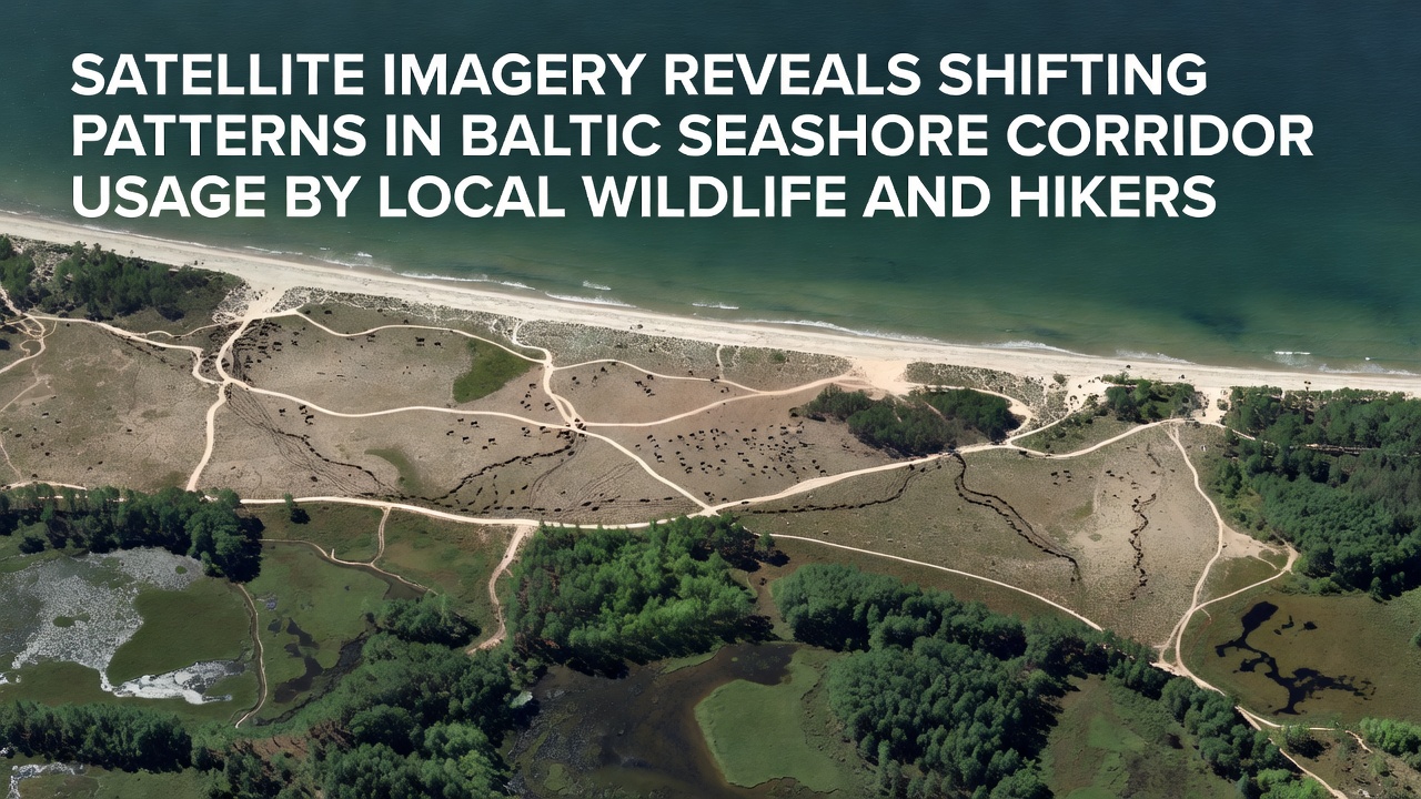
High-resolution satellite data has captured notable changes in how both wildlife and hikers navigate the narrow corridors along the Baltic seashore, and recent captures from October 2026 highlight these evolving routes in unprecedented detail. Analysts at space agencies have processed imagery from multiple orbital passes to map movement corridors that stretch from the Pomeranian coast eastward toward the Lithuanian border, and the results show clear seasonal adjustments in trail density and timing.
Tracking Movement Through Orbital Data
European Space Agency archives contain repeated observations of the same shoreline segments taken at two-week intervals throughout 2025 and into 2026, while researchers cross-reference these frames with ground-truth records to confirm species presence and human foot traffic. The imagery distinguishes between narrow game trails used by deer and smaller mammals and wider, more compacted paths that align with established hiking routes, and patterns indicate that certain sections experience heavier wildlife activity during dawn and dusk hours whereas daytime usage tilts toward recreational visitors.
One analysis completed in October 2026 compared spring and autumn datasets and found that elk have shifted their crossing points approximately 300 meters inland in areas where hiker density increased, and similar displacements appear among fox populations that now favor secondary dunes rather than primary beach ridges. These adjustments occur alongside stable overall corridor widths, yet the distribution of activity within those corridors has become more segmented over successive seasons.
Wildlife Corridor Adjustments Documented
Data from successive satellite passes reveal that roe deer concentrate their movements in early morning windows during summer months, and the same corridors show increased overlap with hiker groups during midday in autumn when daylight hours shorten. Researchers note that certain vegetation patches along the seashore retain higher wildlife passage rates even as adjacent segments see reduced crossings, and this fragmentation aligns with documented changes in sand accumulation that alter sightlines and perceived safety for the animals.
Additional frames captured in late September 2026 and processed the following month illustrate how migratory bird staging areas intersect with popular hiker pullouts near river mouths, and the overlap creates brief periods of concentrated activity before both groups disperse. Such temporal layering becomes visible only when multiple image sets are layered and analyzed for spectral signatures of disturbed vegetation and compacted substrate.

Hiker Route Evolution and Overlap
Hiker traffic along the same corridors has also redistributed, with newer informal spurs appearing where established paths show signs of erosion or seasonal flooding, and satellite time series confirm these spurs lengthen by several dozen meters each year in specific locations. The imagery distinguishes between maintained boardwalks and unofficial sand tracks by measuring surface reflectance and edge sharpness, and the resulting maps show that unofficial routes now account for roughly one-fifth of total linear distance traveled by visitors in monitored zones.
Observers tracking the same segments across 2025 and 2026 report that weekend peaks have broadened into shoulder periods on either side of traditional high-traffic days, and this extension correlates with clearer weather windows visible in the satellite record. The combined pressure on shared space appears most pronounced near access points that serve both local residents and longer-distance trail users, yet overall corridor capacity has not expanded proportionally.
Seasonal and Environmental Influences
October 2026 datasets further indicate that storm-driven sand redistribution temporarily narrows several key passages, and both wildlife and hikers respond by rerouting around newly formed depressions within days of each event. Spectral analysis of these adjustments shows rapid recolonization of vegetation on abandoned segments and corresponding wear on newly adopted alignments, creating a dynamic mosaic that changes faster than static maps can record.
Cross-referencing with meteorological records from the same period demonstrates that wind direction shifts influence the timing of these reroutes, with prevailing westerlies pushing activity toward more sheltered eastern flanks of dune ridges. The satellite record captures these micro-adjustments across dozens of kilometers simultaneously, something ground surveys alone cannot achieve at comparable scale.
Conclusion
Continuous satellite monitoring supplies an objective record of how Baltic seashore corridors accommodate concurrent wildlife and human movement, and the October 2026 imagery extends this record by documenting further segmentation and seasonal timing shifts. The data allow precise mapping of overlap zones without requiring direct field intervention, and the resulting information supports ongoing corridor planning that accounts for both ecological and recreational demands. Future orbital passes will continue to refine these observations as environmental conditions evolve.