Paul Lorenz · 3 September 2026
Mobile Mapping Projects Uncover Seasonal Changes in Northern Poland's Dune Pathways
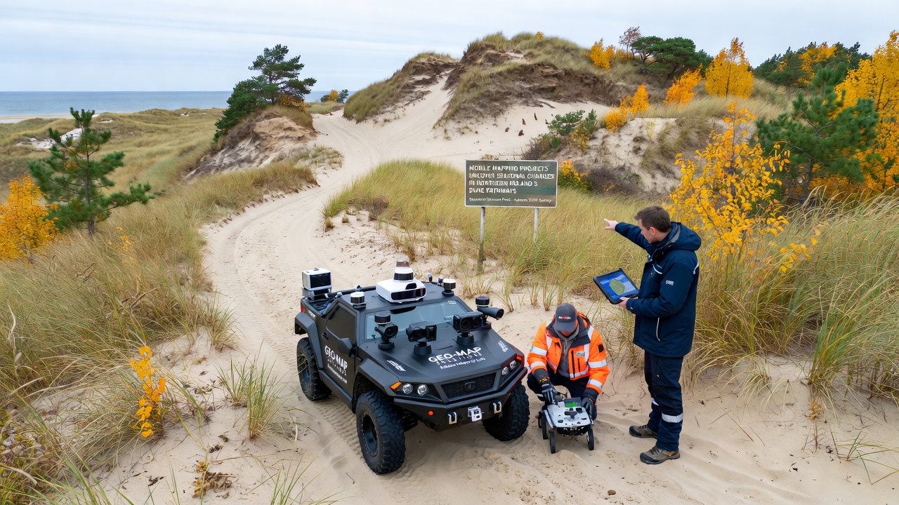
Teams equipped with vehicle-mounted LiDAR and GPS systems have conducted repeated surveys across dune pathways in Northern Poland since 2022, and data collected through these efforts reveal measurable shifts in sand distribution and vegetation cover that align with seasonal weather patterns. Researchers from regional institutions coordinate these mobile mapping runs along established trails near the Baltic shoreline, where wind and precipitation drive the most visible alterations between spring and winter months.
Technology Behind the Surveys
Mobile mapping platforms integrate high-resolution scanners with inertial measurement units, which allows continuous data capture while vehicles traverse narrow dune paths at controlled speeds. These systems generate point clouds that reach densities of several hundred points per square meter, and analysts process the resulting datasets to isolate elevation changes as small as five centimeters across multi-month intervals. Equipment calibration occurs at fixed base stations before each campaign, which minimizes drift and ensures that seasonal comparisons rest on consistent spatial references.
Survey crews typically complete full passes along selected routes in March, June, September, and December, and the September 2026 schedule calls for expanded coverage that will add two additional pathways near the Słowiński reserve. The timing captures post-summer vegetation growth and pre-winter wind redistribution, while the increased route length will provide broader context for ongoing erosion models.
Documented Seasonal Patterns
Analysis of the accumulated point clouds shows that pathways lose an average of twelve centimeters of surface elevation between June and December in exposed sections, whereas sheltered corridors gain up to eight centimeters from wind-deposited sand during the same period. Vegetation indices derived from accompanying multispectral sensors indicate that marram grass coverage expands by roughly eighteen percent from spring to autumn before contracting again under winter storms. These measurements align with wind rose data from nearby meteorological stations, which record dominant westerly flows that funnel sand along established corridors.

One research group cross-referenced mobile mapping outputs with satellite imagery from the Copernicus program, and the combined records confirm that the largest volumetric losses occur within fifty meters of the shoreline where wave run-up reaches the dune toe during autumn storms. Inland sections farther from the beach exhibit slower but steady migration of sand lobes that reshape path alignments over successive seasons.
Integration with Broader Coastal Monitoring
Regional authorities incorporate the mobile mapping outputs into existing coastal zone databases maintained by the Polish Geological Institute, and the layered datasets support updated hazard maps that identify sections requiring seasonal access restrictions. Project reports submitted to the European Environment Agency supply standardized metrics that contribute to Baltic Sea regional assessments, which track cumulative sediment budgets across multiple member states. Collaboration with the institute also supplies historical bathymetric records that extend the temporal baseline for the newer terrestrial surveys.
Technicians have begun testing drone-assisted mobile mapping on sections too narrow for vehicle access, and preliminary comparisons indicate that the airborne systems reproduce elevation trends within three centimeters of ground-based results. The hybrid approach may allow complete coverage of branching trail networks that current vehicle routes cannot reach.
Future Data Releases and Applications
Processed results from the 2025 campaigns will become available through an open repository hosted by the participating universities in early 2026, and the September 2026 field season will generate the first datasets that include the newly added pathways. Planners expect to use these time-series products to refine predictive models of dune migration that inform trail maintenance schedules and visitor guidance systems. Continued mobile mapping will also supply ground truth for emerging satellite-based change detection algorithms that operate at coarser resolutions.
Conclusion
Mobile mapping campaigns continue to deliver precise, repeatable measurements of seasonal dune dynamics along Northern Poland's pathways, and the expanding dataset supplies quantitative support for coastal management decisions. As equipment capabilities advance and coverage widens, the record of elevation and vegetation shifts will grow more comprehensive, which in turn strengthens the foundation for long-term adaptation strategies in the region.